
The FDEM software package supports Ground and Borehole FDEM. It is available standalone or as an add-on to other EMIGMA licenses. An airborne FDEM package is also available for fixed wing or towed system including UAV.
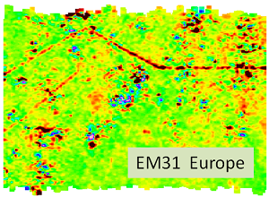
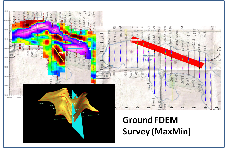
The FDEM apps allow for various geophysical survey configurations. Coil pairs can be horizontal coplanar (GSSI, CMD Explorer, EM31/34/38, Gem2, Max-Min), vertical coplanar (EM31/34/38, GSSI, CMD, Gem2), horizontal co-axial (AEM), broadside co-axial (fixed-wing AEM, EM38), null-coupled (DualEM), vertical co-axial plus virtually any configuration that you may desire. The transmitter and receiver can be housed in the same case or separated by 100s of meters. Depending on the system, single or multiple frequencies are sampled. Borehole FEM includes both fixed and moving configurations. The transmitter is either a large loop set on the surface ground with the receiver moved in the borehole or a dipole source moved along with a 3-component receiver in the same borehole at a constant separation. The cross-hole configuration is also available. Additionally, the application allows for forward models of fixed loop systems although at present there are no data imports for such systems. For grounded sources in the frequency domain, the IP license is suitable.
Data Import
- The license includes a QCTool license. We suggest importing your data into QCTool for QC/QA and other processing prior to import in the .qct format to EMIGMA
- Data imports from ASCII files or manufacturers format
Data Processing and Correction
- 1D digital and spatial filters, 2D spatial filters
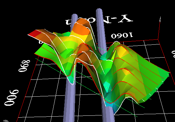
- Data gridding to a multi-parameter grid allowing multiple frequencies/components for easy analyses
- Simple and weighted averaging decimation
- Survey Editor for analyzing and cleaning up your survey points and quick map overlays, extracting focused survey areas or deleted portions of a survey
Data Display and Analyses
- Grids: Natural Neighbor, Delauney Triangulation, Shepard, Minimum Curvature and Thin-Plate-Splines
- Display of Apparent Resistivity as a surface or spatial contour
- Various display tools of volume inversion grids in cross section and depth slices
- Inversion grid editing
- Contours: 2D and 3D surfaces
- Extensive plotting by profile, frequency, component and TX-RX separation
- Easy comparison of inversion to data or model to data
- Model removal from data for enhanced anomaly imaging
- For more detailed data display capabilities, see EMIGMA Complete
3D Modeling

- Volume model primitives - prisms, polyhedra, spheres
- Thin sheet model primitives - 2 algorithms with background layered earth model
- Fast and accurate 3D simulations: model suite generation and batch mode
- Unlimited prism, plate and polyhedra targets
Polyhedra: pipes (hollow cylinders with or without lids), ellipsoids, shells, bullets, landmines, drums, spheres, general polyhedra... - Multiple body interactions
- Modeling of topography effects
- Geophysical modeling of magnetic effects in EM data
- Ability to handle full contrast between host and bodies
- Interactive 3D visual model building tool
1D Inversion

- Multi-Component and/or Multi-Frequency inversions
- Inphase & Quadrature selectable for each component
- Two algorithms to choose from
- Smooth Occam joint susceptibility/resistivity inversion with fixed layer thickness with user defined starting models
- Underparametrized Marquardt style inversions
- Invert for thickness and/or resistivity of each layer
- User defined starting models
- User defined parameters for inversion
- Full resistivity and thickness constraints
- Spatial smoothing capabilities
- Incorporation of GPS_Z information
- Volume cross section and depth slice viewing and extraction
3D Inversion
- Multi-Component and/or Multi-Frequency inversions, Inphase/Quadrature or Quadrature only
- Three algorithms to choose from
- Smooth Occam resistivity inversion with fixed layer thickness
- Smooth Occam joint susceptibility/resistivity inversion with fixed layer thickness with user defined starting models
- Underparametrized Marquardt Inversions - invert for thickness and/or resistivity
- User defined starting models
- User defined parameters for inversion
- Full resistivity and thickness constraints
- Spatial smoothing capabilities
- Suite of minimization techniques
- Incorporation of GPS_Z information
CDIMAP
- Apparent Resistivity Tool - a half-space mapping technique for generating apparent resistivities as a function of frequency
- Sengpiel Depth-Sections - a resistivity pseudosection technique for generating resistivities as a function of pseudo-depths (only airborne)
Exports
- Export of images to postscript files, raster or GeoTIFF formats
- Export of modeled, inverted, processed data or grids to XYZ ASCII files
- Geosoft exports
- GeoTutor exports
- Scalable or unscalable hardcopies