
![]() Download Airborne TDEM&FDEM Description
Download Airborne TDEM&FDEM Description
Download Airborne FEM demo database
Download Airborne TEM demo database
(works with EMIGMA's DEMO version)
Airborne TDEM software package is available as an add-on to other EMIGMA Premium packages or as a standalone product. The package includes the tools for ground and borehole TDEM data. There is also a package for airborne FDEM for fixed wing, towed helicopter or ground loop to UAV mounted receivers.
EMIGMA provides configurations of helicopter TDEM systems for both central loop and Slingram styles. Surface loop sources to UAV mounted receivers are also supported . In the airborne FDEM method, the transmitter and receiver coils are generally housed in a single case and are towed by a helicopter, whereas airborne TDEM transmitters are either attached to the fixed wings, nose and tail of an aircraft and a 3-component receiver is housed in a towed bird or the system has a towed transmitter with one or more receivers. Presently, there are systems in development with the loop on the ground and the receivers mounted on a platform carried by a UAV. These systems are also supported in our app.
Airborne FDEM and TDEM surveys offer the advantage of collecting large amounts of data over a relatively short period of time and not being limited by the geophysical survey size, EMIGMA allows for rapid airborne modeling and inversion within a full conductive contrast range from massively conducting targets in a resistive environment to resistive targets inside a conducting earth, for any number of plates, prism, polyhedra and sphere anomalies. EMIGMA is an excellent tool for survey design as well as for interpreting your data and for understanding EM scattering processes.
Data Import
- Airborne TDEM (VTEM, SKYTEM, XCite, Genesis, Tempest as well as older archived GeoTEM/MegaTEM/HeliTEM, and AeroTEM) as ASCII or binary XYZ or by .gdb through QCTool. QCTool is provided with the license. QCTool has the advantage of allowing easy QC/QA and data merging and cleaning of your survey prior to import to EMIGMA for interpretation
- FDEM airborne data imports via either ASCII or .qct files and some manufacturer's formats. As older data is often delivered in a .gdb format, it can be imported to QCTool, manipulated and then the resulting .qct file may be imported very simply to EMIGMA. For new stystems using a ground loop and UAV mounted receivers we can adapt an import for your data.
Data Processing and Correction
- 1D digital and spatial filters , 2D spatial filters
- Simple and weighted averaging decimation. As airborne data is often oversampled when compared to the height and size of the TX, it can be beneficial to decimate the data. Using a weighted average decimation reduces noise levels as it is decimating.
- Average duplicates, remove outliers, merge lines or surveys, tie line leveling
- Data Spreadsheet tool combining dynamic spreadsheets and line plotter for data cleaning, missing data interpolation and simultaneous plotting of different data channels for fast cross-analysis
Data Display and Analyses
- Display of data over flight altitude variations, GPS positions
- Display of FDEM Apparent Resistivity as a surface or spatial contour
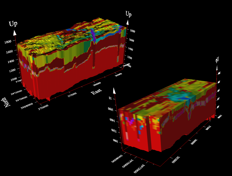
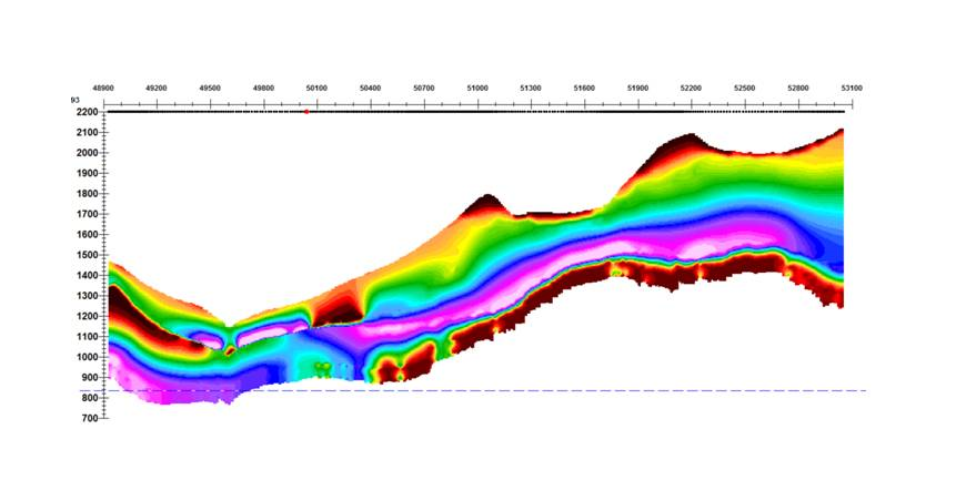
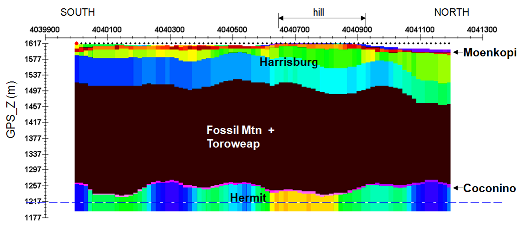
- 2D representation of geoelectric sections or depth slices
- Grids: Natural Neighbor, Delauney Triangulation, Shepard, Minimum Curvature and Thin-Plate-Splines
- Contours: 2D and 3D surfaces
- Time decay rate and amplitude contours (TDEM)
- Multi-parameter grids for quick, comprehensive data analyses
- Extensive plotting tools
- Survey Editor for cleaning, map underlays and cutting out focused area
- Residual plots
- Overburden model removal processing
- For more detailed data display capabilities, see EMIGMA Complete
3D Modeling
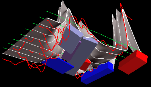
EM modeling with data
overlays and surface
- Fast and accurate 3D simulations: model suite generation and batch mode
- Prisms, thin-sheet plates, polyhedra and sphere targets
- Multiple body interactions
- Modeling of topography effects
- Modeling of magnetic effects in EM data
- Accounting for variations in resistivity, susceptibility and Cole-Cole parameters
- Ability to handle full contrast between host and bodies
- Incorporation of altitude information
- Interactive 3D model building tool
1D TDEM Inversion
- 2 Inversion techniques - Smooth Occam and a discrete layer Trust Region
- 2 Forward techniques - one is approximate utilizing a causal transform and the other is accurate using accurate system response
- User defined starting model - multiple starting models allowed
- User defined inversion parameter and constraint definitions
- Multi-station, Multi-parameter inversions allowed
- Spatial inversion weighting
- Production orientated - inversions saved at regular intervals, inversion parameters saved to recoverable log files, inversion progress outputs, intermediate stops and restarts allowed
1D FDEM Inversion
- Multi-Component and/or Multi-Frequency inversions
- Inphase and/or Quadrature selectable for each component
- Smooth Occam joint susceptibility/resistivity inversion with fixed layer thickness with user defined starting models
- Discrete/Sharp layer contrast inversions
- Invert for thickness and/or resistivity
- User defined starting models
- User defined parameters for inversion
- Full resistivity and thickness constraints
- Spatial smoothing capabilities
- Incorporation of GPS_Z information
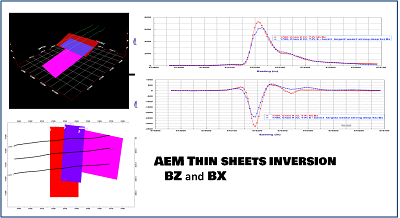
3D Thin Sheet Plate Inversions
- Time domain and frequency domain
- Airborne, ground and borehole
- Inversion for single or multiple thin sheets
- Invert selectable time windows, frequencies
- Multiple selectable components
- Survey region selectable
- Starting models
- Model constraints
- Background response can be included (e.g. cover response)
- Multi-processed app
CDIMAP FDEM
- Apparent Resistivity Tool - a half-space inversion technique for generating apparent resistivities as a function of frequency
- Sengpiel Depth-Sections - a resistivity pseudosection technique for generating resistivities as a function of pseudo-depths
Export
- 3D models may be exported to CAD formats including .dxf
- Export 3D .pdf with rotational viewing
- Model, Processed Data export to XYZ ASCII, .GBN, .QCT
- Projects/surveys/datasets may be exported to other EMIGMA databases (measured, modeled, inverted)
- Inversions exportable as volumes or depth slices or cross sections
- 3D grids to XYZ ASCII or Geosoft/Surfer formats
- Free viewer for sharing results